Quantum Tech FPV – Comprehensive Aerial Surveying & FPV Drone Services, LiDAR/Photogrammetry, Pune India
Core Services & Expertise
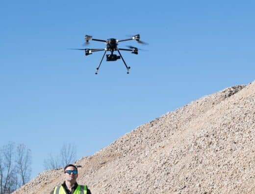
Quantum Tech FPV operates redefining boundaries of aerial surveying and 3D mapping through next-generation drone technology as industry leaders in FPV (First Person View) drone solutions specializing in delivering high-precision aerial data for energy, construction, transportation, and infrastructure sectors. Beyond commercial surveying providing comprehensive FPV drone retail, repair, and specialized aerial filming services with passion for FPV flight evolved from hobby into mission to redefine skies.
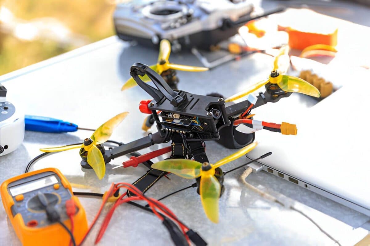
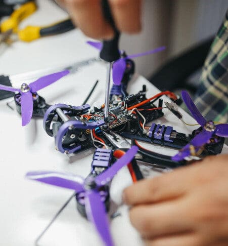
Core services: Comprehensive aerial surveying (turbine inspection, construction site mapping and monitoring, road planning and infrastructure development, railway surveys and monitoring, solar farm inspection, mining and quarry surveying), FPV drone services (comprehensive diagnostics, precision repairs, soldering expertise, component replacement), aerial filming (real estate shoots for residential/commercial properties, entertainment coverage for concerts/sports, wedding shoots for ceremonies/receptions, surveillance for property/forest/geo mapping, documentaries for nature/urban), retail products (FPV drones, drone components, motors and propellers, frames, batteries).
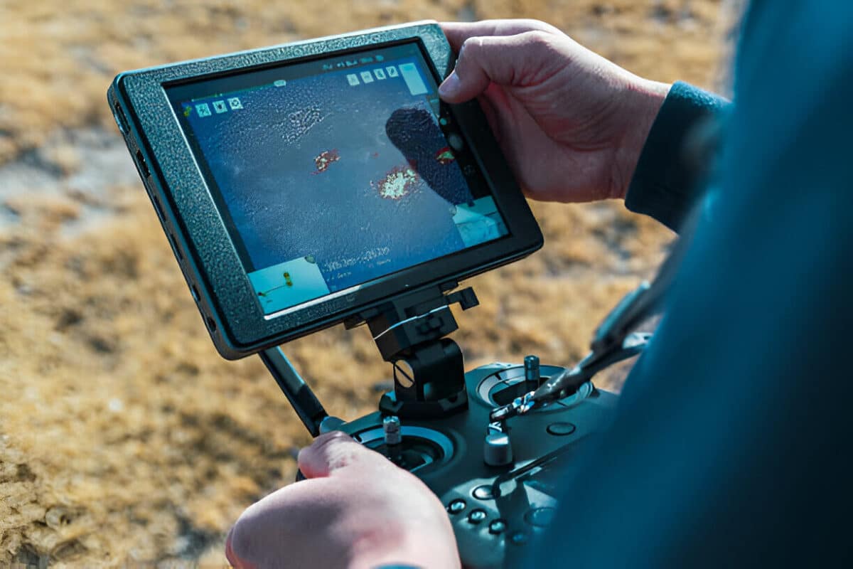
Advanced technology: Fleet of advanced drones equipped with state-of-the-art LiDAR sensors, photogrammetry cameras, RTK/PPK GPS systems, and multispectral imaging enabling coverage of vast areas up to 2 square kilometers in under 3 days ensuring every square meter captured with meticulous accuracy. LiDAR (creates dense 3D point clouds for accurate terrain modeling through dense vegetation), photogrammetry (generates orthomosaic maps, 3D models, contour lines with centimeter-level accuracy), thermal imaging (identifies heat anomalies in structures and equipment).
Geographic Reach & Capabilities
Location: Shop no 17 A Wing, KPCT Mall, Fatimanagar, Pune – 411040, India. Services covering energy, construction, transportation, and infrastructure sectors with specialized capabilities for turbine inspection (4K cameras capturing microscopic cracks, erosion, delamination plus thermal sensors identifying overheating components and electrical anomalies with 360° blade coverage), construction site mapping (topographic surveys generating digital terrain models and digital surface models, progress monitoring with time-lapse imagery, 3D modeling and BIM integration), railway surveys (track alignment and deformation monitoring, bridge and tunnel inspections, vegetation encroachment analysis).
Survey techniques: Orthomosaic mapping (high-resolution georeferenced maps for site analysis), 3D point cloud generation (detailed models for structural assessments and volumetric calculations), digital elevation models (elevation data for flood risk assessment, drainage design, landscape analysis), volumetric analysis (material stockpiles, excavation volumes, landfills with high accuracy). Coverage capabilities ensuring actionable insights driving efficiency, safety, and cost-effectiveness.
Industry Credentials & Partnerships
Quantum Tech FPV maintains expertise across multiple verticals with state-of-the-art equipment ensuring superior video quality and stability. Expert pilots licensed and experienced skilled in capturing perfect shot in any environment or event. 10K+ hours of work with 9+ projects demonstrating operational experience. 213% client satisfaction (noting unusual percentage suggests strong commitment metric).
Specialized applications: Solar farm inspection (thermal imaging for hotspot detection identifying underperforming panels, panel alignment and shading analysis, electrical fault detection in junction boxes/connectors/inverters), mining and quarry surveying (volumetric stockpile measurements for inventory management, pit and bench mapping with 3D models for planning and slope stability analysis, blast planning and monitoring capturing pre/post-blast data), road planning (corridor mapping for alignment and route selection, slope analysis and cut-fill calculations, pavement condition assessment detecting defects/potholes/cracks).
Client Benefits & Advantages
Clients selecting Quantum Tech FPV benefit from comprehensive aerial surveying with repair capabilities:
-
- 2 sq km in 3 days: Coverage of up to 2 square kilometers in under 3 days demonstrates efficient large-area surveying capability
-
- Centimeter-level accuracy: Photogrammetry and RTK/PPK GPS systems ensure precision for engineering and construction applications
-
- LiDAR through vegetation: Dense 3D point clouds through vegetation enables terrain modeling in forested areas
-
- BIM integration capability: 3D modeling integrates with Building Information Modeling software for construction workflows
-
- Thermal inspection expertise: Identifies overheating components, solar panel hotspots, and electrical anomalies without physical access
-
- Full repair services: Component replacement, soldering, calibration, firmware updates eliminates need for external drone maintenance
-
- Creative aerial filming: FPV expertise enables dynamic shots for real estate, weddings, entertainment, documentaries
-
- Retail and service hub: One-stop solution for drone purchase, customization, repair, and commercial surveying services
These capabilities combine to create comprehensive drone surveying solutions focusing on infrastructure inspection, construction monitoring, and energy sector applications with LiDAR, photogrammetry, and thermal imaging technology covering 2 sq km in 3 days with centimeter-level accuracy plus full FPV drone retail and repair services based in Pune, India.
Quick Facts:
-
- Location: Pune, India (Shop 17 A Wing, KPCT Mall, Fatimanagar – 411040)
-
- Specialization: Aerial surveying, 3D mapping, FPV drones, turbine/solar/railway inspection, construction monitoring, mining surveying
-
- Technology: LiDAR sensors, photogrammetry, RTK/PPK GPS, thermal imaging, multispectral imaging
-
- Coverage: Up to 2 square kilometers in under 3 days with centimeter-level accuracy
-
- Industries: Energy, construction, transportation, infrastructure, mining, real estate, entertainment, weddings
-
- Services: Aerial surveying, drone repair/servicing, FPV drone sales, aerial filming, 3D modeling, BIM integration
-
- Experience: 10K+ hours work, 9+ projects, 213% client satisfaction
-
- Products: FPV drones (₹110K-200K), drone components, motors, frames, batteries, flight controllers
Contact Details:
Address: Shop no 17 A Wing, KPCT Mall, Fatimanagar, Pune – 411040, India
Phone: 9960515892 / 9922466459
Email: business@quantumtechfpv.com
Website: quantumtechfpv.com
Please sign in to see contact details.
Location
Similar Listings


Add Review
Claim listing

Please sign in to see contact details.
Leave a Reply